Austin’s Blackland Prairie reforestation project underway
Thursday, August 10, 2023 by
Nina Hernandez The work to restore Austin’s heavily degraded Blackland Prairie floodplain has begun with the help of local urban forestry nonprofit TreeFolks.
The Environmental Commission heard an update on the results of the city’s Blackland Prairie ecoregion study at its regular meeting Aug. 2. The study was intended to expand the Watershed Protection Department’s understanding of the state of the prairie’s riparian corridors and come up with a plan of recommendations for follow-up actions.
Around 800 miles of streams in the Blackland Prairie fall in Austin’s jurisdiction. Thirty-three acres of the local prairie are creek buffers. Austin is responsible for protecting those, as well as 11,000 acres of floodplain outside them.
Watershed Protection Division Manager Ana Gonzalez presented the findings to the commission. She noted that development intensity is high in that area and continues moving east. As a result, many of the streams are in poor condition.
“There’s a lot of equity and environmental justice components that are important to consider,” Gonzalez said. “And really our ability to survive in Austin and thrive as climate change is making life more hostile here. Our ability to survive really hinges a lot on the condition of our streams. It’s such a crucial network.”
Gonzalez explained the study was aimed at characterizing the current condition of the riparian vegetation and the stream itself, as well as the anticipated effects of development and impervious cover that are continuing to move in that direction.
The study found that impervious cover, unlike in the Hill Country and the city’s urban core, did not serve as a good predictor of the condition of the stream. In urban areas, there is a clear relationship between development and more severe degradation.
“So we are finding very low impervious cover and still highly degraded conditions in the streams in the Blackland Prairie,” Gonzalez said. “It’s kind of a pretty straightforward relationship that falls apart in the Blackland Prairie.”
The study also found that the Blackland Prairie riparian areas are in worse conditions than urban streams and Hill Country streams.
“Usually you think, no development, you know, things are a little bit better – not for Blackland Prairie, in terms of canopy cover, tree demography and species diversity,” Gonzalez said. “So our stream riparian areas are in pretty bad shape, and of course even worse than Hill Country streams for those parameters.”
In the past, the presence of biological elements in the stream held the system together. According to the study, most Blackland Prairie streams no longer benefit from the once protective and stabilizing system of natural grade controls that slowed down erosion. Debris dams as a result of beaver activity are now rare.
“What appears to have held the thing together were trees and biological action by beavers,” Gonzalez said. “Those were two components that were present in the landscape that have been eliminated.”
Another finding of the study: Most of the streams have high turbidity, meaning that they are muddy and cloudy. That is in contrast to the clear streams that early settlers to this region documented.
“It’s like these depressions in the prairies that held water and slowed it down,” Gonzalez explained. “Those things are gone. So it’s all this sediment moving from the drainage area, but also as part of the stream as the storms erode the stream bed and bank. They are incredibly unstable now.”
The report recommends revising restoration provisions within the Critical Water Quality Zone, working within the department’s Rain to River Strategic Planning framework to incorporate protection specific to Blackland Prairie streams, improved asset management, active riparian restoration and land protection.
Gonzalez emphasized the active restoration recommendation: “OK, we have no canopy, the streams are completely devoid of vegetation, we need to go plant trees on the streams” to kick-start the system, she said. “It is going to take forever to do that, but we need to get started soon.”
Watershed Protection pitched the idea of a floodplain reforestation program to a slew of national and local groups, including Natural Resources Conservation Service, the Texas Land Conservancy, Nature Conservancy and TreeFolks.
The department ultimately partnered with TreeFolks, a riparian sapling planting nonprofit, to conduct a co-pilot.
“It was very interesting, because we pitched the idea, and it’s very rare that you pitch an idea and the organization takes it and runs with it. And that’s exactly what they did,” Gonzalez said.
TreeFolks agreed to a five-year contract with the Watershed Protection Department in 2021. As outlined in the contract, the organization will plant 20,000 saplings and native tall grasses on floodplain land annually, provide professional marketing and educational materials to landowners and register carbon credits. TreeFolks is paid $125,000 per year for these services.
So far, TreeFolks has planted trees on 56 different sites and 239 acres across Williamson, Hays, Travis, Blanco and Caldwell counties. In total, the program has resulted in the planting of 212,839 trees.
The nonprofit has plans to double the output of the program over the next five years. That would reforest more than 575 acres, produce 60,000 carbon credits and grow 515,000 saplings.
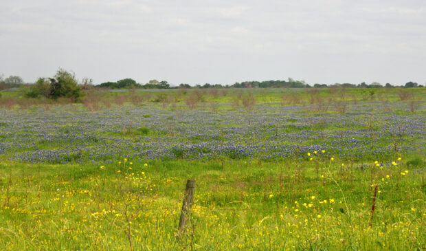
Photo by William L. Farr, CC BY-SA 4.0, via Wikimedia Commons.
The Austin Monitor’s work is made possible by donations from the community. Though our reporting covers donors from time to time, we are careful to keep business and editorial efforts separate while maintaining transparency. A complete list of donors is available here, and our code of ethics is explained here.
blac
You're a community leader
And we’re honored you look to us for serious, in-depth news. You know a strong community needs local and dedicated watchdog reporting. We’re here for you and that won’t change. Now will you take the powerful next step and support our nonprofit news organization?


