Downtown mobility plan reaches next stage of development
Thursday, November 7, 2019 by
Ryan Thornton The Austin Transportation Department has kicked off the second and final phase of development for its Austin Core Transportation Plan, a document that will serve as a comprehensive guide for downtown right of way management into the future.
Leading up to next summer, the department will continue the data collection work of the first phase and will initiate a series of public engagement periods later this year to help develop the plan’s priorities and refine the existing project database.
While the plan will focus on downtown mobility, it will also address the impact of regional transportation patterns on the downtown grid. Specifically, Council Member Paige Ellis told transportation staffers Tuesday, the plan needs to consider tools, like park-and-rides and dedicated transit lanes, to relieve the urban core from regional car dependency.
“We can’t just keep adding capacity,” Ellis said. “We’re kind of at max road capacity right now and the only way to accommodate more people in the downtown core area is going to be to start improving on some of our other modes of transportation.”
Cole Kitten, division manager of urban planning and policy with Transportation, assured the committee that the plan will include projects that fall outside of downtown. In addition to facilitating movement in the urban core, he said, the plan will certainly look at all elements leading into downtown.
That could include, for example, a park-and-ride that is linked to a major transit route under Project Connect. It will also consider the possible impact of regional projects like the Texas Department of Transportation’s intention to expand Interstate 35 with managed lanes in the Capital Express Project.
The plan is an update to both the 2002 Downtown Access and Mobility Plan and the 2008 Transportation Framework component of the Downtown Austin Plan.
A lot has happened since then, said Liane Miller, a senior business process consultant with Transportation. From developments in transit and bicycle planning to evolving best practices and shared electric scooters, she said, “We have a lot of reasons that we want to revisit some of those assumptions in those plans.”
The plan will also offer a new level of detail on mobility and safety projects that are included. In addition to high-level plans like Project Connect or the Austin Strategic Mobility Plan, it will incorporate concentrated efforts like the Rainey Mobility Study, the 2016 Mobility Bond, the Palm District Plan, and the Congress Avenue Urban Design Initiative.
The Congress plan, Miller said, is especially helpful because it demonstrates how to work within the existing right of way. “A lot of downtown is built out,” she said. “We’re not necessarily expanding our roadways, but reimagining how we can allocate that space is something that we will be doing.”
In this case, “reimagine” doesn’t mean scrapping what came before. Between the 2001 Great Streets Master Plan and the 2011 Downtown Austin Plan, Miller said the department will hardly be starting from scratch. This plan will update the city’s vision for downtown with the latest standards in speed management, pedestrian and bicycle facilities, placemaking, signalized intersections, and curb management.
All of these plans and standards will meet in the Core Transportation Plan to help the city meet its mode share goals outlined in the ASMP and dive deeper into the role downtown mobility will have in meeting those goals.
Since downtown will likely need to carry a lot of weight to reach the 50/50 mode share goal, Miller said the plan will include more information on many of the downtown projects mentioned in the ASMP.
“This is an opportunity for us to really highlight the projects that, maybe from a system perspective or a citywide perspective, were identified in the ASMP,” Kitten elaborated. “But then we can take it to the next level, solicit more feedback, a little more specifics around the projects themselves, and then include those costs for any funding opportunity.”
Using the ASMP as a basis, the department will use updated data in this final phase of development to get a better idea of future street conditions. After that, staff will review policies from other plans, put it all together and deliver the final document near the end of summer 2020.
That final product will include the main body text and policy framework, an aspirational list of projects in varying development stages, individual project costs, a review of the most transformative projects, and visualizations of the projects to help the public see what downtown could look like.
The plan may also include recommendations gathered during the Shared Streets Pilot on Rainey Street, now scheduled to launch Dec. 5 and extending to March 8, 2020. In its current form, the pilot will close Rainey Street to vehicles and dockless scooters between Driskill and River streets from 9 p.m. to 2:30 a.m. on Thursday, Friday and Saturday nights.
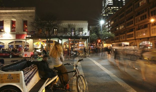
This story has been updated to reflect the new start date of the Rainey Street pilot program. Photo by Ed Schipul made available through a Creative Commons license.
The Austin Monitor’s work is made possible by donations from the community. Though our reporting covers donors from time to time, we are careful to keep business and editorial efforts separate while maintaining transparency. A complete list of donors is available here, and our code of ethics is explained here.
You're a community leader
And we’re honored you look to us for serious, in-depth news. You know a strong community needs local and dedicated watchdog reporting. We’re here for you and that won’t change. Now will you take the powerful next step and support our nonprofit news organization?


