How climate change could impact the road ahead for infrastructure in Austin
Tuesday, June 27, 2017 by
Mose Buchele, KUT As greenhouse gasses heat the atmosphere, we can expect more severe floods and droughts. That could be trouble for critical infrastructure like bridges and roads in many cities, including here in Central Texas.
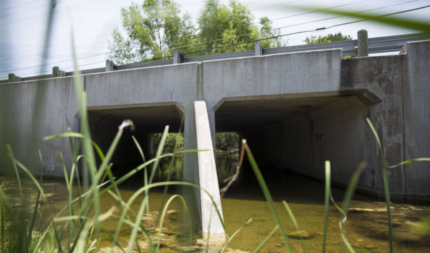
Take Southeast Austin, where a creek runs under Hoeke Lane and floods happen even during moderate rainfall.
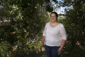
“This is the only way in and out of this whole neighborhood right here,” Pam Kearfott, an engineer with the city’s Watershed Protection Department, said on a recent summer afternoon. “We would have the road going underwater a lot … so our crews would have to come and shut the road down a lot.”
That’s why a few years ago, the city upgraded the bridge. Walking over it now you get the feeling that it’s longer than it needs to be, but look closely beneath the bridge and you see evidence that the area has been flooded relatively recently.
“These are all culverts underneath that convey the water through here,” Kearfott said. “The higher the water gets these culverts engage to convey that flow.”

The city is looking at up to 10 other locations where raising bridges or adding culverts might be a good idea. Sometimes, like in the case of Hoeke Lane, that’s because design standards have improved. Other times it’s because flood risk has increased.
That’s where climate change comes into play.
“The problem is actually quite common all over the country,” said Jim Schwab, who just retired as manager of the Hazards Planning Center for the American Planning Association. He said most bridges were built before we understood how global warming leads to more severe weather.
“If we can assume bigger floods, bigger rainstorms, the net result is that the bridge may need to be higher than it is now,” he said. “What that calculation is is a very local thing, obviously.”
A couple of years ago in Austin, the Capital Area Metropolitan Planning Organization commissioned a study on how climate change could affect bridges, roads and rail lines. It found potential vulnerabilities due to increased flooding, drought or extreme heat.
Kearfott said the bridge on Hoeke Lane needed work notwithstanding climate models, and that other factors, like the increased use of surfaces that don’t absorb rain, also add to flood risk.
“To us the data is the data, and if we have information that shows that our 100-year-storm event should be bigger than what were currently modeling, then we’ll work to incorporate that,” she said.
The challenge, she said, is to build infrastructure that will serve our city and our climate 50 years from now.
This story was produced as part of the Austin Monitor’s reporting partnership with KUT. Photos by Gabriel Cristóver Pérez/KUT News. Top photo: Even moderate rainfull can cause the creek under Hoeke Road to overflow and flood the road.
The Austin Monitor’s work is made possible by donations from the community. Though our reporting covers donors from time to time, we are careful to keep business and editorial efforts separate while maintaining transparency. A complete list of donors is available here, and our code of ethics is explained here.
You're a community leader
And we’re honored you look to us for serious, in-depth news. You know a strong community needs local and dedicated watchdog reporting. We’re here for you and that won’t change. Now will you take the powerful next step and support our nonprofit news organization?


