Growing up: Council wrestles with competing water and housing needs
Tuesday, May 7, 2019 by
Ryan Thornton Between an invasion of zebra mussels, an extended boil-water notice due to continued flooding and the concerning results of the Atlas 14 regional rainfall study, city water problems have crowded to the surface in the months since the last land use code rewrite attempt was scrapped.
Preparing to pick up where that process ended, City Council asked city staff Thursday to give water a central role when drafting a new code with a text and map that will coordinate with the city’s Water Forward plan, decrease citywide allowable impervious cover, improve water quality, and reduce flooding.
Given the city’s housing goals and growth projections, Council Member Alison Alter said constituents are struggling to reconcile the apparent contradiction between increasing entitlements to promote development while reducing allowable impervious cover.
“Overall we’re increasing the capacity of our zoning code a lot with this direction,” Alter said. “I’m still not totally understanding how you do this big change and end up with a reduced amount of allowable impervious cover.”
Alter specifically mentioned the interiors of single-family neighborhoods, where so-called “transition zones” extending outward from Imagine Austin Comprehensive Plan activity corridors and Austin Strategic Mobility Plan transportation priority network routes would encourage multiple units to take the place of or be added onto current single-family lots.
Those transitions zones are indeed likely to see an increase in total allowable impervious cover under the new code, explained Greg Dutton, a principal planner with the Planning and Zoning Department. In contrast, due to decreases in impervious cover in other – mostly commercial – zoning categories, Dutton said the net impact in citywide allowable impervious cover is likely to be neutral or slightly less than what is zoned today.
As Council Member Jimmy Flannigan emphasized, impervious cover will continue to increase whether or not the development code is updated due to the inevitability of new projects going up on greenfield tracts. Rather than actually reducing impervious cover, Council is asking that the code reduce how much may legally be added as the city continues to grow.
For example, total impervious cover projections were trending downward in various previous code rewrite drafts due to adjustments to large-scale commercial zoning categories, explained Matt Hollon, manager of the Watershed Protection Department Planning Division.
Referring to language in Draft 3 of CodeNEXT that would have doubled the percentage of allowed impervious cover in some parcels along corridors, Alter said counterbalancing those relaxations with tighter restrictions in other areas may not be adequate to mitigate flooding along those corridors.
But according to both Hollon and Dutton, increasing the density along corridors doesn’t necessarily mean harming the watersheds or drastically increasing impervious cover.
One solution, Hollon said, is to build up rather than out.
“Watershed Protection is sort of neutral on height, so we’re okay as long as we’re leaving the impervious cover and natural function intact,” he said.
Council Member Leslie Pool further pressed the issue with adopted language directing staff to make sure impervious cover and water quality changes are considered in individual watersheds, not just citywide.
Echoing those concerns, Council Member Ann Kitchen mentioned the need for more thorough consideration of drainage and flooding in individual site plans, using South Lamar as an example of that failure.
“Currently in the South Lamar neighborhood area, there’s been significant infill development, which is fine – that neighborhood has not objected to that – but at the same time that has caused increased flooding and there’s been no assessment of the impact on increased flooding in our site development process,” Kitchen said.
Hollon, however, countered that narrative, which appeared to place too much blame for the city’s water problems on development.
“South Austin, unfortunately, has gotten bombed a couple of times with record flooding, so you have a lot of overlapping things going on where people are seeing a lot of development going in, they’re seeing this incredible rainfall, there’s flooding, and then it turns out that a lot of the drainage systems can’t even handle what we call, maybe, a two- or five-year flood,” Hollon said. “So those are already overwhelmed and development is not necessarily … adding to the problem, but people kind of associate it with the problems.”
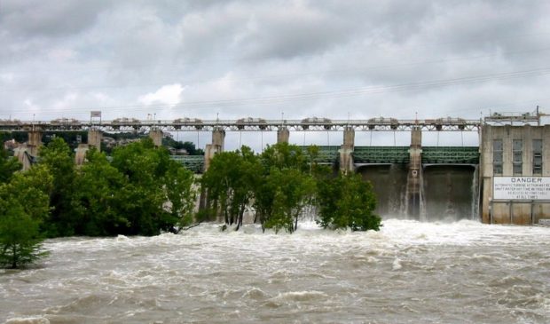
Photo by Wade Treichler made available through a Creative Commons license.
The Austin Monitor’s work is made possible by donations from the community. Though our reporting covers donors from time to time, we are careful to keep business and editorial efforts separate while maintaining transparency. A complete list of donors is available here, and our code of ethics is explained here.
You're a community leader
And we’re honored you look to us for serious, in-depth news. You know a strong community needs local and dedicated watchdog reporting. We’re here for you and that won’t change. Now will you take the powerful next step and support our nonprofit news organization?


