Council greenlights update to urban trails, sidewalks and bikes plan with last-minute amendments
Tuesday, December 5, 2023 by
Kali Bramble As the city prepares for a decade of unprecedented public transportation and highway infrastructure projects, Austin’s Transportation Department is making moves to spread the love to those choosing to walk, bike or roll.
Since early last year, staff has been devising updates to the 2019 Strategic Mobility Plan, a sprawling vision charting the path forward for capital improvements to Austin’s streetscapes. The two-year-long effort came to fruition at last week’s City Council meeting, where members unanimously approved the update to the plan’s urban trail, bicycle, and sidewalk and crossing goals alongside amendments addressing community concerns in districts 4, 5 and 8.
The bulk of Thursday’s discussion concerned updates to the city’s Urban Trails Plan, which since 2014 has steered the expansion of Austin’s urban trail system from around 30 miles to nearly 60 miles in total. The updated plan outlines around 268 miles of potential trail projects, each categorized into one of three tiers ranging from lowest to highest priority. Also included in the update’s directives: fine-tuning a more robust annual maintenance budget, amenities like wayfinding and lighting and a comprehensive ADA assessment of existing trails.
One proposed trail project stoked controversy among South Austin homeowners, who took to Council chambers to argue that the neighborhood had not been consulted about impacts to privately owned land. Speakers said the proposed trail segments, which would have run along sections of greenbelt through the Knolls at Slaughter Creek and the Village of Santa Leanna, would require excessive private property easements.
“Our neighborhood – along with the Knolls at Slaughter Creek, Santa Leanna and Shady Hollow – was absolutely shocked to see trails located on private lands without acknowledgement for the consent of the landowner,” said Texas Oaks South homeowner Heather Venhaus. “We are yet to find one landowner who was contacted by the city of Austin.”
“I have young children on my property … and the proposed trail could potentially pose safety risks and a public nuisance, providing easier access for unauthorized individuals to trespass into our yards,” added homeowner Eve Gaddini.
Though away on paternity leave, Council Member Ryan Alter sprang to action behind the scenes to omit the contested sections from the final plan, directing staff to consider alternatives through nearby public land such as Mary Moore Searight Park. The amendment passed without objection, alongside an amendment from Mayor Pro Tem Paige Ellis bumping up from medium to high priority an ongoing trail project from the U.S. Highway 290 and Highway 71 split at Oak Hill to the Barton Creek Greenbelt near MoPac Expressway.
The ASMP’s Bicycle Plan and Sidewalks, Crossings, and Shared Streets Plan also received face lifts, fine-tuning priorities among the 810 miles of planned sidewalks, 370 miles of planned shared street spaces and 805 miles of planned biking infrastructure based on a lengthy research and community engagement process. Investments in tree canopy, vegetation management and closing the city’s many “crossing gaps” in highly trafficked areas have also been added to the list of goals.
Council Member Chito Vela also seized the opportunity to address traffic concerns in District 4, authoring an amendment to extend Crestview’s Dale Drive, currently a dead end, all the way to Anderson Square.
“The area between Anderson Square, Anderson Lane and Highway 183 is going to be redeveloping in the medium term, and if we can extend that street it will let vehicles, bicyclists and pedestrians connect directly into the development without having to get on Anderson Lane. In the long term, I think it’s a good idea for traffic flow,” Vela said to the dais, who passed the motion unanimously. For more information about the new-and-improved Austin Strategic Mobility Plan, check out an interactive street network map on the city’s website.
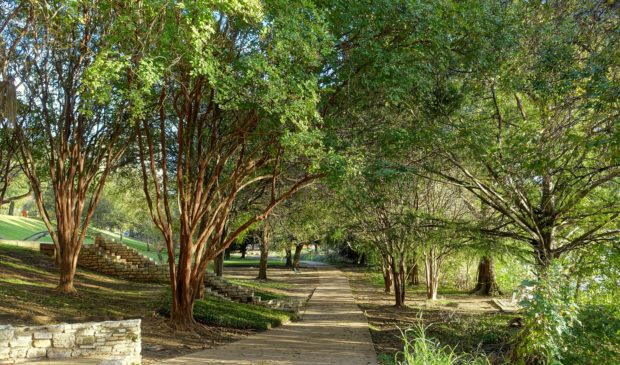
Photo of the Ann and Roy Butler Hike-and-Bike Trail by Daderot, CC0 1.0, via Wikimedia Commons.
The Austin Monitor’s work is made possible by donations from the community. Though our reporting covers donors from time to time, we are careful to keep business and editorial efforts separate while maintaining transparency. A complete list of donors is available here, and our code of ethics is explained here.
You're a community leader
And we’re honored you look to us for serious, in-depth news. You know a strong community needs local and dedicated watchdog reporting. We’re here for you and that won’t change. Now will you take the powerful next step and support our nonprofit news organization?