Travis County partners with Texas Water Development Board on flood planning
Friday, June 7, 2024 by
Lina Fisher Excessive rain isn’t typically something Austinites are concerned about in this drought-stricken era, but our region is unfortunately prone to catastrophic floods, too. Luckily, the first-ever statewide flood plan is set to be taken up by the Legislature – and Travis County is at work on its own Master Flood Plan with help from a Texas Water Development Board grant.
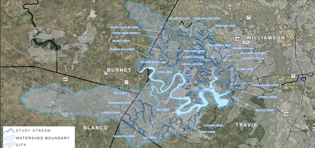
The county is seeking public input as it gathers information about existing stormwater infrastructure such as bridges, culverts, channels and detention facilities; evaluates mitigation strategies; and develops a database of low-water crossings. A virtual open house runs until June 21, aimed at collecting input from the community on the highest-risk areas for flooding. That feedback will help the county update its floodplain maps, along with recent rainfall data provided by the National Oceanic and Atmospheric Administration (NOAA).
The Federal Emergency Management Agency (FEMA) evaluates flood risk based on the “100-year flood,” which is the one that has a 1 percent chance of happening in any given year. The most recent NOAA rainfall data for the county (from 2018) shows there has been up to a 3.5-inch increase, bumping up the risk for a 100-year flood to a 2 percent chance. That may not sound like a big increase, but combined with recent reports that governments have failed to take into account climate change when planning for floods, it’s imperative that Texas take a closer look at its infrastructure’s resilience.
The Texas Water Development Board began this planning process in 2019, when the Legislature directed TWDB to create 15 regions across the state based on river basin boundaries. Travis County is part of Region 10, which includes the Lower Colorado and Lavaca river basins and stretches all the way from just south of Abilene to the Gulf Coast.
If TWDB’s plan is adopted in the Legislature’s next session in 2025, funding could be unlocked for risk reduction projects. The city and county could collaborate on mitigation strategies such as buyouts of high-risk neighborhoods once they’re identified. For example, about 800 homes in the Onion Creek watershed were acquired by the city after the area experienced disastrous flooding in 2013. Other strategies include keeping up with stormwater infrastructure, like building detention ponds to reduce water flowing downstream. New developments are required to install stormwater detention ponds, but older neighborhoods like Tarrytown that were built before floodplain regulations don’t have that infrastructure.
The county’s planning process began this spring. Its team has already completed historic rainfall data collection and is now analyzing rainfall data from new gauging stations that weren’t there when the last study was conducted in 1998. After the county completes new floodplain maps, an in-person public meeting is planned for early 2025 to share results of the study.
You can find out more and add comments about your experience with flooding at the Travis County Master Flood Plan page or by emailing TravisCountyMFP@halff.com.

The Austin Monitor’s work is made possible by donations from the community. Though our reporting covers donors from time to time, we are careful to keep business and editorial efforts separate while maintaining transparency. A complete list of donors is available here, and our code of ethics is explained here.
You're a community leader
And we’re honored you look to us for serious, in-depth news. You know a strong community needs local and dedicated watchdog reporting. We’re here for you and that won’t change. Now will you take the powerful next step and support our nonprofit news organization?


