Map pinpoints how we roll
Wednesday, January 19, 2022 by Tai Moses
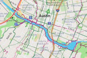 Austinites now have a way to let the city know precisely where they’d like to see improvements in the city’s walking and bicycling infrastructure. The handy online tool is called the ATX Walk Bike Roll Public Input Map, and according to the city’s news release, it allows residents to “pinpoint where they’d like to see improved street crossings, new bikeway and urban trail routes, and where barriers need to be addressed.” Assistant City Manager Gina Fiandaca said the new mapping tool “presents a unique opportunity to evaluate all of our active transportation plans at the same time. Our residents know their streets best. We need this ground-level feedback from the Austin community to make the most of this opportunity and get these plan updates right.” The tool will be accepting feedback through March 6. Learn more about the ATX Walk Bike Roll initiative.
Join Your Friends and Neighbors
We're a nonprofit news organization, and we put our service to you above all else. That will never change. But public-service journalism requires community support from readers like you. Will you join your friends and neighbors to support our work and mission?

